Afghanistan
Afghanistan Flood Risk Exposure Map for ES-NFI Cluster
Title
Afghanistan Flood Risk Exposure Map for ES-NFI Cluster
Publisher
IM AFG ESNFI
Date
Type
Information Management
Source
Shelter Cluster
Response
Language
English
Description
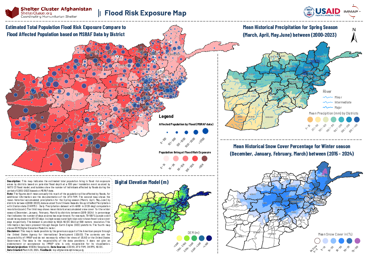
The Afghanistan Flood Risk Exposure Map for ES-NFI document offers an integrated analysis of flood risk across Afghanistan, providing insights into the population's exposure to flood hazards, historical precipitation patterns, snow cover, and terrain elevations. It features a comprehensive flood risk exposure map based on the NATO C3 flood model and MSRAF data, estimating the population living in high-risk areas from 2012 to 2023. Additionally, it charts spring season precipitation from 2000 to 2023 and winter snow cover percentages from 2015 to 2024, utilizing datasets from CHIRPS and NASA's NSIDC DAAC, respectively.